
Wednesday we drove about 200 miles east of home to Bend, Oregon. Part of the trip was on the "Over the River and Through the Woods Scenic Byway." It winds along rushing streams and through thick forests as it climbs into the Cascades to join the West Cascades and McKenzie Pass-Santiam Pass National Scenic Byways.
We checked into the hotel around 2:30 PM and wanted to go do a little something. So we set off for Lava Butte - which is about 10 miles from the hotel. HOWEVER - it's closed on Tuesdays and Wednesdays. So we opted to go about 4 miles further down the road to Behman Falls.
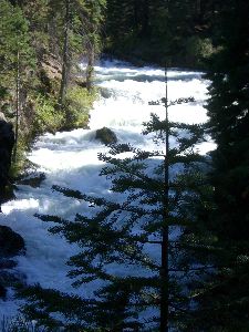 |
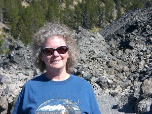
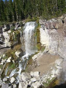
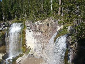
A very nice hard packed trail winds along the Deschutes River. The sign said 1/2 mile to the falls - but I think it was a little longer. There were LOTS of ground squirrels and chipmunks all over the place. Echo was very interested in them! |
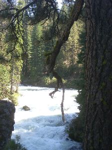 |
Rather than a waterfall it's more like a series of rapids. But very pretty and a nice walk. |
 |
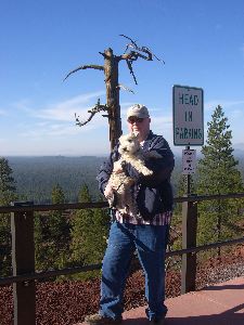
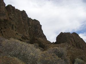
Thursday morning we went to Lava Butte. There is a narrow, but well paved, road that winds it way up to the top of the 500 foot high volcanic peak. At the top is a very small parking lot and a lookout tower. AWESOME 360 degree view. |
 |
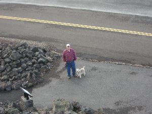
Michael and Echo at the rim. I couldn't really get a good shot of the Lava Butte cinder cone. |
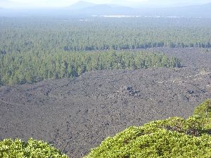 |
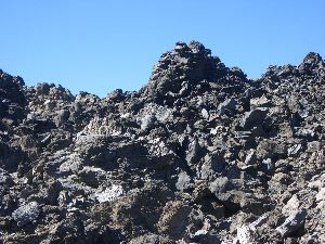
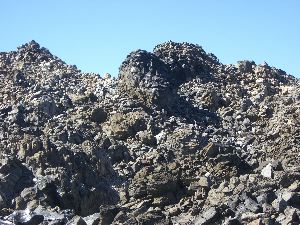
But the view of the surrounding lava flow is pretty cool. |
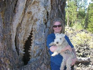 |
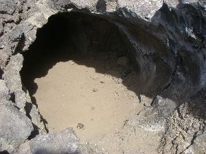
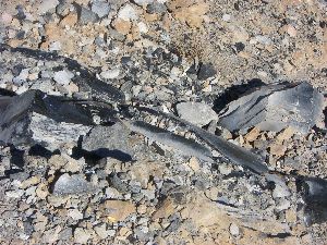
A few miles away and down a 9 mile "unimproved road" - they should have said gravel and dirt washboard that will rattle your teeth - is the Lava Cast Forest and this scary tree. |
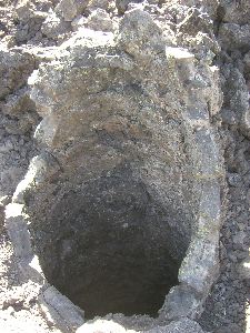 |
The 1 mile paved self guided interpretive trail offers barrier free access. The trail loops through an area where hot molten lava erupted from the northwest flank of Newberry Volcano and engulfed the forest 7,000 years ago. |
 |
The huge trees in the area acted like dams in the cooling lava. The lava piled up behind and around the tree. The tree burned, died and eventually disintegrated. The landscape now includes the "casts" or molds of these ancient trees. |
 |
It was bright, sunny and in the mid 80"s. Much warmer than the mid 60's Echo is use to. He took advantage of shady stops. |
 |
I thought the twisted wood of this more recent tree "skeleton" was kinda interesting. |
 |
While I took pictures the little terrier took another shade break. |
 |
View across the lava field to the mountains. |
 |
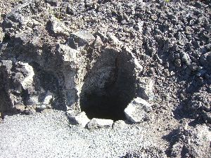
When the lava surged through the forest some trees were knocked over but held in place by their root system. The lava cover them creating cave like molds. |
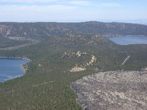 |
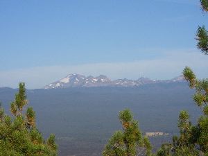
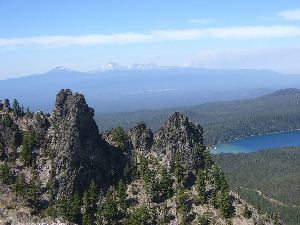
Next stop Paulina Peak, the highest point on Newberry Volcano. Summit elevation is 7984 feet. The road to the top is another "unimproved" road. The view of Paulina and East Lakes along with the lava field is beautiful. |
 |
To the right of the mountains in the background you can see the smoke from the wildfire burning southwest of Sisters. |
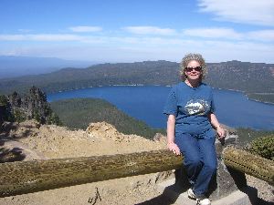 |
Paulina Lake is over 250 feet deep in some places making it a beautiful blue color. |
 |
Then it was off to Big Obsidian Flow. This picture is especially for my sister Pati. When she was here she really wanted an Obsidian rock - but signs everywhere say REMOVE NO ROCKS! |
 |
At only 1300 years ago, the flow represents the most recent eruption in Central Oregon. Obsidian is lava that cooled into a glassy structure, which means that it didn't crystallize before it solidified. |
 |
The trail winds through towering walls of lava. The picture doesn't really show it well but there are a lot of shiny obsidian rocks. |
 |
Echo got to stay behind with Michael because the crushed rock path was too rough for his paws. |
 |
OK - maybe I shouldn't be wearing a Colorado shirt in an Oregon lava field. |
 |
Last stop of the day Paulina Falls. Now this is more like it, although there is a lot more water over the falls in the springtime. |
 |
This double falls drops 60 feet onto a jumble of rocks below. |
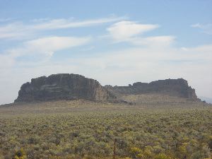 |
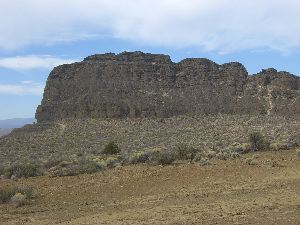
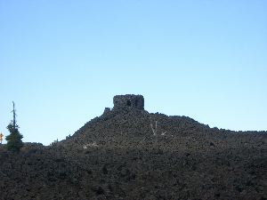
Friday we went to Fort Rock. Fort Rock is about 70 miles from Bend. You take the "Outback Scenic Byway" through the Deschutes Forest. Then you make a turn and in a short drive the forest opens into a vast prairie. You drive along about 10 more miles and this huge rock formation appears. |
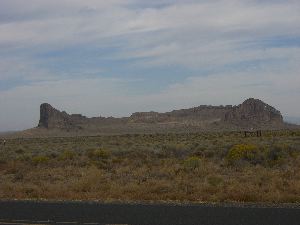 |
When a small volcano erupted in a lake, the reaction of magma and water resulted in a maar that built a ring-shaped body of cemented ash or tuff along the rim of the crater. The lake waters later eroded into the tuff ring, breaching one side, and later still the lake dried up. The result is Fort Rock, a National Natural Landmark. |
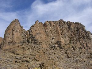 |
The ring is about 4,460 feet in diameter and stands about 200 feet high above the surrounding plain. |
 |
You can walk around the inside and if you are brave {or foolish} there are paths you can take to climb up part of the wall. |
 |
Echo wasn't very impressed. He rested while I wandered around taking pictures. |
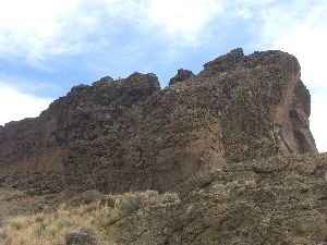 |
At its maximum, the water in Fort Rock Lake was estimated to cover nearly 900 square miles and was about 150 feet deep where the Fort Rock tuff ring formed. |
 |
The extensive terrace on the side of Fort Rock marks one lakeshore about 14,000 years ago. Even higher water levels are recorded on the tuff cliffs and at one point only the tops of the tuff ring were exposed as rocky islands in this inland sea. An age of about 21,000 years ago has been found for this highest lake level. |
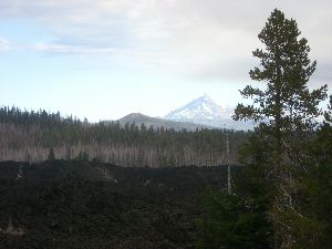 |
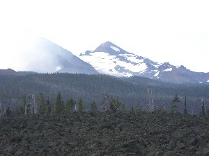
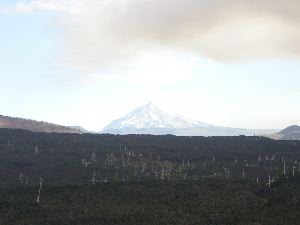
Saturday we headed home with a side trip to the Dee Wright Observatory. Great view of Mt. Jefferson on the way. |
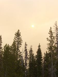 |
Smoke from the fire outside Sisters was pretty thick giving the sun a strange glow. |
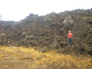 |
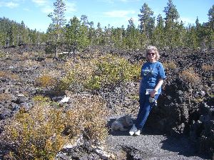
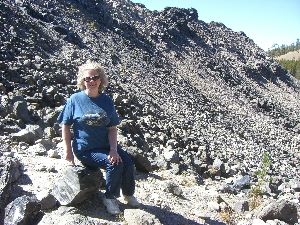
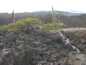
Here the lava flow was very close to the road. So we stopped for a picture. |
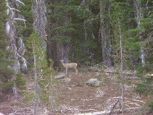 |
This deer wasn't shy at all and posed nicely for a picture. |
 |
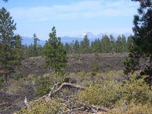
The view across the lava field to the mountains from the base of the Observatory. |
 |
Little chipmunks were running all over the place. I think they would have run right up my leg while I took pictures if Michael didn't keep running them off! |
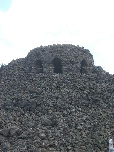 |
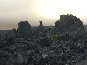
The Dee Wright Observatory is located at an elevation of 5,187 feet, in the Oregon Cascades. The Civilian Conservation Corps, built it from lava rock in 1935. |
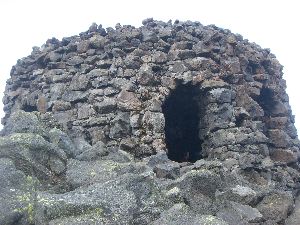 |
This unique structure has "lava tube" viewing holes for windows, allowing for incredible views of the Cascade Mountains. |
 |
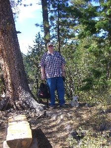
Michael and Echo stayed down below so Echo wouldn't have to climb the steps |
 |
View from the top of the Observatory. |
 |
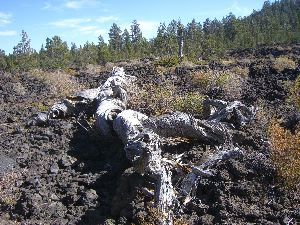
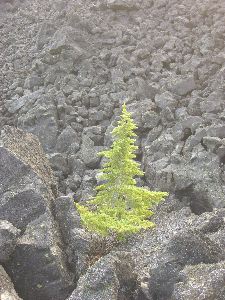
This long dead tree becomes a nursery for new trees. |
 |
Looking across the lava field to the Dee Wright Observatory. |
 |
Plants grow anywhere a little dirt accumulates. |
 |
Last look - then we headed for home. |