
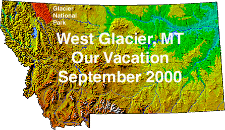
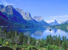
These pictures were taken on our trip to Glacier National Park in Montana September 16th through September 21st of 2000. Michael took hundreds of pictures. I picked the best ones then he cropped and sized them for me to display. Click on any thumbnail and a new window will open with a larger version so you can better see the detail.
 We stayed at Glacier Wilderness Resort which is truly a wilderness resort located 10 miles past "the middle of nowhere." We flew into Kalispell International Airport - the airport has 3 arrival/departure gates! The directions to the resort go like this: when leaving the airport turn left onto North Highway 2. At the junction of MT40 and Highway 2 (stoplight) take Highway 2 East. The resort is 28.9 miles from this intersection. Follow Highway 2 East
through West Glacier (The middle of nowhere. There are a couple restaurants,
hotels, a gas station and a few gift shops.) Just past mile marker 163 turn right at the Glacier Wilderness sign. Follow gravel road 1/4th mile to reception center.
We stayed at Glacier Wilderness Resort which is truly a wilderness resort located 10 miles past "the middle of nowhere." We flew into Kalispell International Airport - the airport has 3 arrival/departure gates! The directions to the resort go like this: when leaving the airport turn left onto North Highway 2. At the junction of MT40 and Highway 2 (stoplight) take Highway 2 East. The resort is 28.9 miles from this intersection. Follow Highway 2 East
through West Glacier (The middle of nowhere. There are a couple restaurants,
hotels, a gas station and a few gift shops.) Just past mile marker 163 turn right at the Glacier Wilderness sign. Follow gravel road 1/4th mile to reception center.
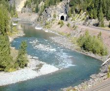 |
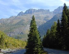
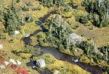
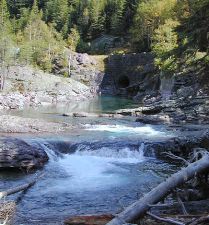
The "Middle Fork Flathead River" flows along the road to the resort, as do the train tracks. We heard the train several times a day/night blowing it's whistle. |
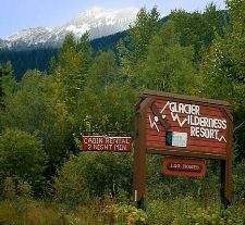 |
Here is the entrance to the resort. There is nothing in the way of "civilization" for 10 miles west or 50 miles east! There is a phone in the resort office but none in the cabins. No pager or cell phone coverage out here and only satellite TV. |
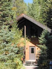 |
This is the front of our cabin. There are 11 cabins on the property. |
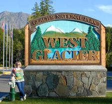 |
Here I am at the entrance to the "shopping district." A grocery store, restaurant, couple gift stores, motel and visitor center. |
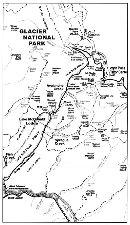 |
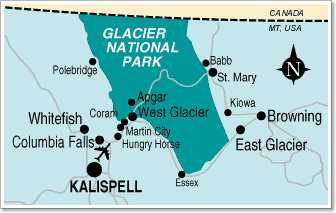
This little map shows the route through the park. Going to the Sun Road is 52 miles from West Glacier to St, Mary. It is a spectacular drive! |
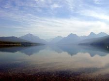 |
Saturday we drove Going to the Sun Road for the first time. This is a look down Lake McDonald from the Apgar Visitor Center area. |
 |
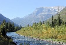
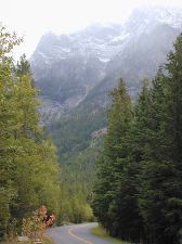
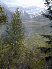
Mountains, rivers, creeks and forest line the two lane twisting road. |
 |
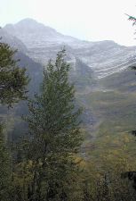
Off in the distance is Heaven's Peak. |
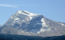 |
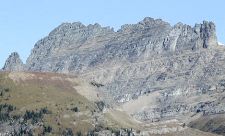
This is Heaven's Peak closer. It soars 8987 feet and has snow year round. |
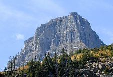 |
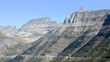
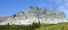
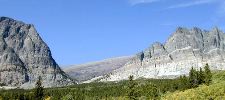
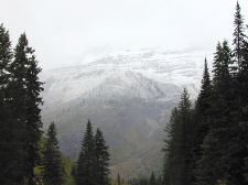
This is one of the many peaks along the road. |
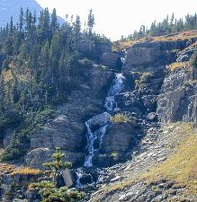 |
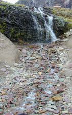
Waterfalls were everywhere even this late in the year. |
 |
This is part of "The Garden Wall" |
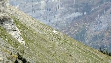 |
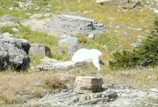
This was the 1st Mountain Goat we saw. It was off on the side of the mountain eating. |
 |
This is the view down from where we saw the Mountain Goat. Can you find the moose? |
 |
We couldn't find one either. But I was told it was prime moose area. |
 |
More ridges along the road. Each more amazing than the last. |
 |
Not all wildlife co-operates when you try to take pictures. This Mountain Goat was eating just off the road. Every time Michael focused - he put his head down. Look up from the camera and the goat would look right at you. This went on for several tries. We ended up with lots of goat butt pictures! |
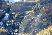 |
Now this mom and kid were very good at posing. They just lay in this crevice by the waterfall and watched everyone snap pictures. |
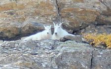 |
Aren't they cute! |
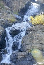 |
This is the falls just next to them. We are now just below Logan's Pass. |
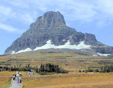 |
This is Reynolds Mountain which is 9125 feet. It's at Logan Pass and the trail goes out to Hidden Lake which is about 1.5 miles out and to the left of the mountain. (we'll walk it another day) |
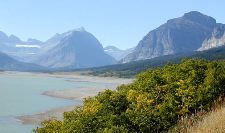 |
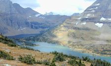
This is a look down St. Mary Lake. |
 |
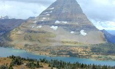
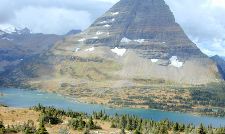
This is Goose Island in the middle of St. Mary Lake with Fusillade Mountain in the background. The lake is about 10 miles long and 300 feet deep. |
 |
I think these are part of the Apikuni Mountains (9068 feet) along the way to Many Glacier. |
 |
These are also along the road to Many Glacier. We planned to return to Many Glacier another day to hike and take pictures - but things didn't work out that way. |
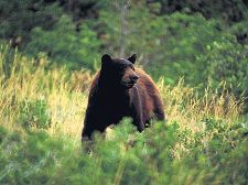 |
Along this road there were several cars pulled off and people watching with binoculars. Being tourists, we stopped and asked what they saw. There was a Black Bear mom and cub eating berries on the hill side. I lost track of how long we watched them. |
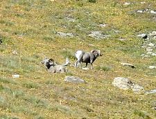 |
Coming back through Logan's Pass there were cars pulled over and people looking at the hill side. So we parked and looked to see what was there. We saw these two Big Horn Sheep. |
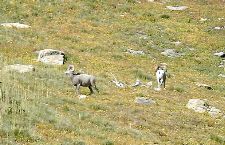 |
They kept looking up the mountain - so Michael scanned higher up and there were 6 or 7 more Big Horn Sheep walking a small ridge. They went around a curve and disappeared. |
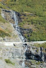 |
This is Haystack Falls. I can imagine in the Spring the water really pours down along the road! |
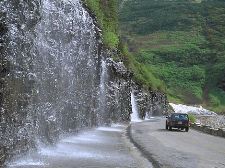 |
This is called Weeping Wall. There was still water in September. May and June runoff must really be something to see. |
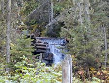 |
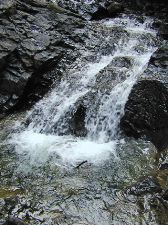
Sunday we wandered some of the trails on the resort property. This fall is on Great Bear Creek about a 1.5K walk. |
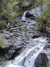 |
This fall is on Skiumah Creek. |
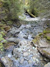 |
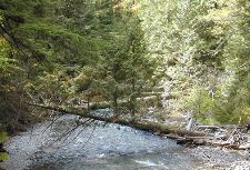
We actually crossed this bridge - brave aren't we! |
 |
This picture was from the other side of the bridge. |
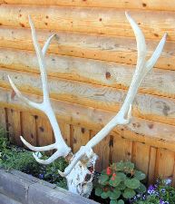 |
Michael wanted to bring this home to my Dad. But after the "elk horn through the airport incident" (most of you know the story) Mom said NO MORE BONES! So we let it be. |
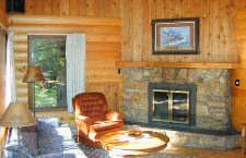 |
This is the living room of our cabin. |
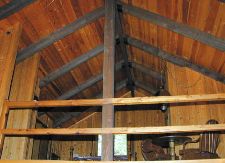 |
Up in the loft was a bedroom, bathroom and sitting area. |
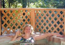 |
After a long day of hiking a soak in the hot tub with a drink was just the ticket. This was the only hot tub day. There was a change in the weather Monday. |
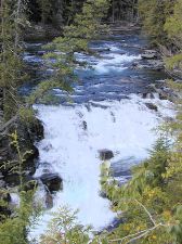 |
Monday we went back to the park. This is McDonald Falls. |
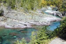 |
The water in McDonald Creek was this beautiful blue/green color and crystal clear. |
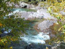 |
Sacred Dancing Waters flow down to the falls. |
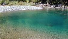 |
There were many deep pools of very cold, clear water. |
 |
Each spot along the creek was so pretty you just had to stop and walk along a little. |
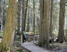 |
This is Trail of the Cedars at Avalanche Creek. |
 |
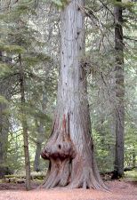
We called this "Pumpkin Face" |
 |
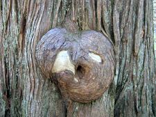
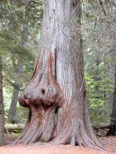
A very strange knot in a large cedar. |
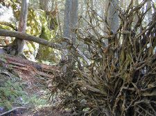 |
These trees have hundreds of shallow roots. |
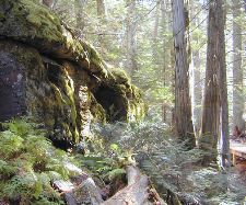 |
Dripping waters make mossy rocks through the trees. |
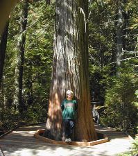 |
The path goes right around this big tree. |
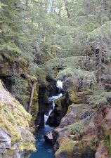 |
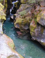
Avalanche Gorge - the sound of water running over the rocks was so pretty. I bet in May and June it's deafening! |
 |
Beautiful, clear and cold water flow down the falls into the creek. |
 |
Try to find the 3 trees growing out to the top of this downed tree. How did they ever find enough soil to put down roots? |
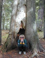 |
You never know what little gnome you'll find sitting in a hollow tree. |
 |
Does this tree make you think of anyone? |
 |
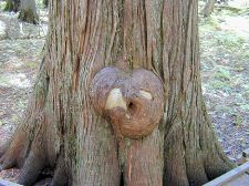
This was another strangely knotted tree. |
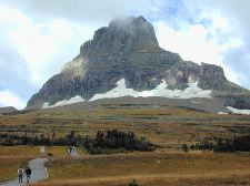 |
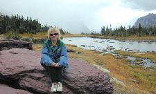
Tuesday was overcast and cool with the threat of rain. We decided to go out to Logan's Pass to hike out to Hidden Lake. The one way distance is 1.5 miles. The trail climbs 500 feet from an elevation of 6680 feet above sea level at the visitor center. |
 |
Dark storm clouds were rolling in over The Garden Wall. It was kinda chilly up here. We bundled up for the hike. |
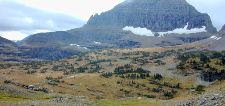 |
This is a look out over the valley from the trail to Hidden Lake. |
 |
A small waterfall. There were trickles of water all along the trail. Needless to say, the trail is closed in the very early Spring. |
 |
Hidden Lake lies 800 feet below the view point. The trail does continue down to the lake. But what goes down, must come back up and we weren't ready for that! |
 |
This point just about straddles the Continental Divide. Mt. Reynolds and Sperry Glacier are off in the distance. |
 |
You can't see it in the picture, but there were snow flurries falling!! The wind was rather brisk and cold. Time to head back! To think home in CA the temp was 88 degrees. |
 |
The red in the mudstone rocks is from the mineral hematite. The green is from clorite. (I copied that from the trail map) |
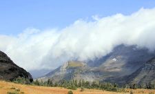 |
Sure looks like snow coming as the clouds boil over the mountain peaks. |
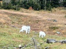 |
I think this is the same Mom and kid as before. We saw them several times. |
 |
Here they are just off The Highline Trail peacefully eating. |
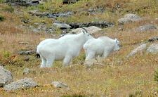 |
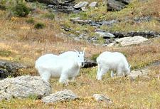
They didn't seem to mind people at all. One day we saw them on the Highline Trail. People were in front & behind them. The people in front scrambled up on some rocks and the goats just walked by! |
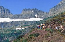 |
This is Highline Trail. It follows a ledge on the side of the mountain. I was chicken to try it - too high and narrow for my tastes. |
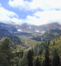 |
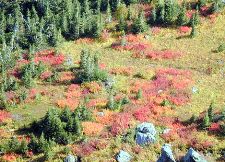
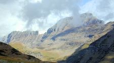
This was an avalanche area. You can see the distant mountains are pretty bare from past snow slides. |
 |
Beautiful mountains and valleys. I think this is one of the "hanging" valleys. |
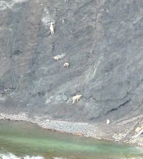 |
Wednesday we headed out East on Highway 2 towards East Glacier and Two Medicine Lake. We stopped at "Goat Lick" |
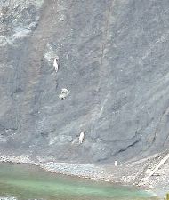 |
The Mountain Goats climb on this shear rock face to actually lick the salt. There were 5 goats on the rocks and 1 laying up on the top by the tree line. It was amazing to watch. |
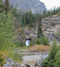 |
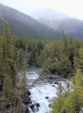
This is "Running Eagle Falls" on the Two Medicine River. |
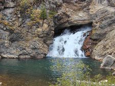 |
This pool was very deep, clear and cold. |
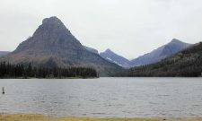 |
This is Two Medicine Lake. It was very grey and windy. We didn't get out of the car except to take pictures. No hiking today. |
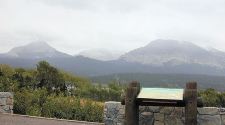 |
Distant mountains with snow clouds coming in. |
 |
Thursday morning it was 28 degrees at the cabin. We drove into the park but The Going to the Sun Road was closed 24 miles in. You can see fresh snow on the mountains. |
 |
Lots of fresh snow in the higher elevations. There were light flurries down below. |
 |
New snow in the avalanche area. |
 |
The wind was really blowing - the first day of Fall and Winter is coming. |
 |
Parts of Going to the Sun road are open year round. But I think Logan's Pass may be closed for the season. |